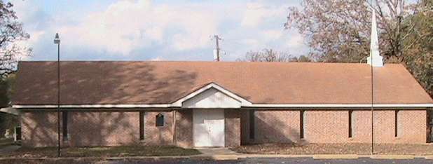

Liberty Missionary Baptist Church
From Henderson, take Hwy 79 east to the county line. Turn left (north) onto FM 3231 (County Line Rd, intersects 79 at FM 1798). Go north about two miles and turn left (west) onto FM 1251. Go less than one mile and turn left (west) onto CR 397. There is a sign for the cemetery at this intersection. Go less than one mile and the church and cemetery are on the right.Coordinates:
32°11.046N
094°35.799W
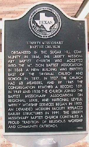
Marker Text
Organized in the Sugar Hill community in 1866, the Liberty Missionary Baptist Church was accepted
into the Mt. Zion Baptist Association in 1868. A new building was erected east of the original church and school in
1897. In 1927 the church had 68 members, and by 1945 the congregation reached a record 159. In 1949 and 1950 the church
joined the Baptist Missionary Association on regional, state, and national levels; weekly worship services began in
1952. An expanded modern facility replaced earlier structures in 1991. The Liberty Missionary Baptist Church continues a
proud tradition of religious worship and community outreach. (1998)